Is there anywhere online that you can get Orthophoto from? I still cant get my TBC to open the background images. Also, since we dont do any flights at my current company beside them flying a helicopter for just images. It would be nice to be able to access current photo to make plots
Some states have a database of downloadable orthos, and some of our more populated counties do additional flights every year or two. Some of the flights can get 4-5 years old, depending on how long it takes the state to re-fly. I know there is imagery available in Indiana and Idaho.
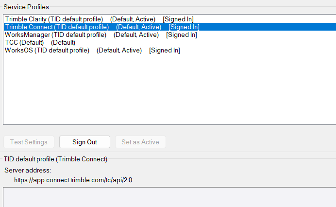
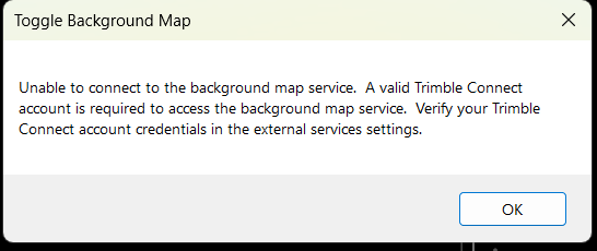
since I was unable to get help else where. Does anyone have an idea why i cant know get my background images to show. I have my TID signed in . I have logged out and back in with no change
using image from another post
I haven’t been able to get the imports to scale to my project yet (running the trial) but GlobalMapper might be exactly what you need. let me know if you get it to work ;p the lidar surfaces it pulls are famous, just wrong scale and location. or wrong scale. something. Anyhow, contour maps, orthophoto’s, lidar. its got it all.
anyone ever run into the issue of not being able to open the background map?
Some versions ago it wasn’t working for me. But generally, as long as I am signed in it loads. It can be a huge resource call and can take some time to populate. Maybe version or computing power/bandwidth?