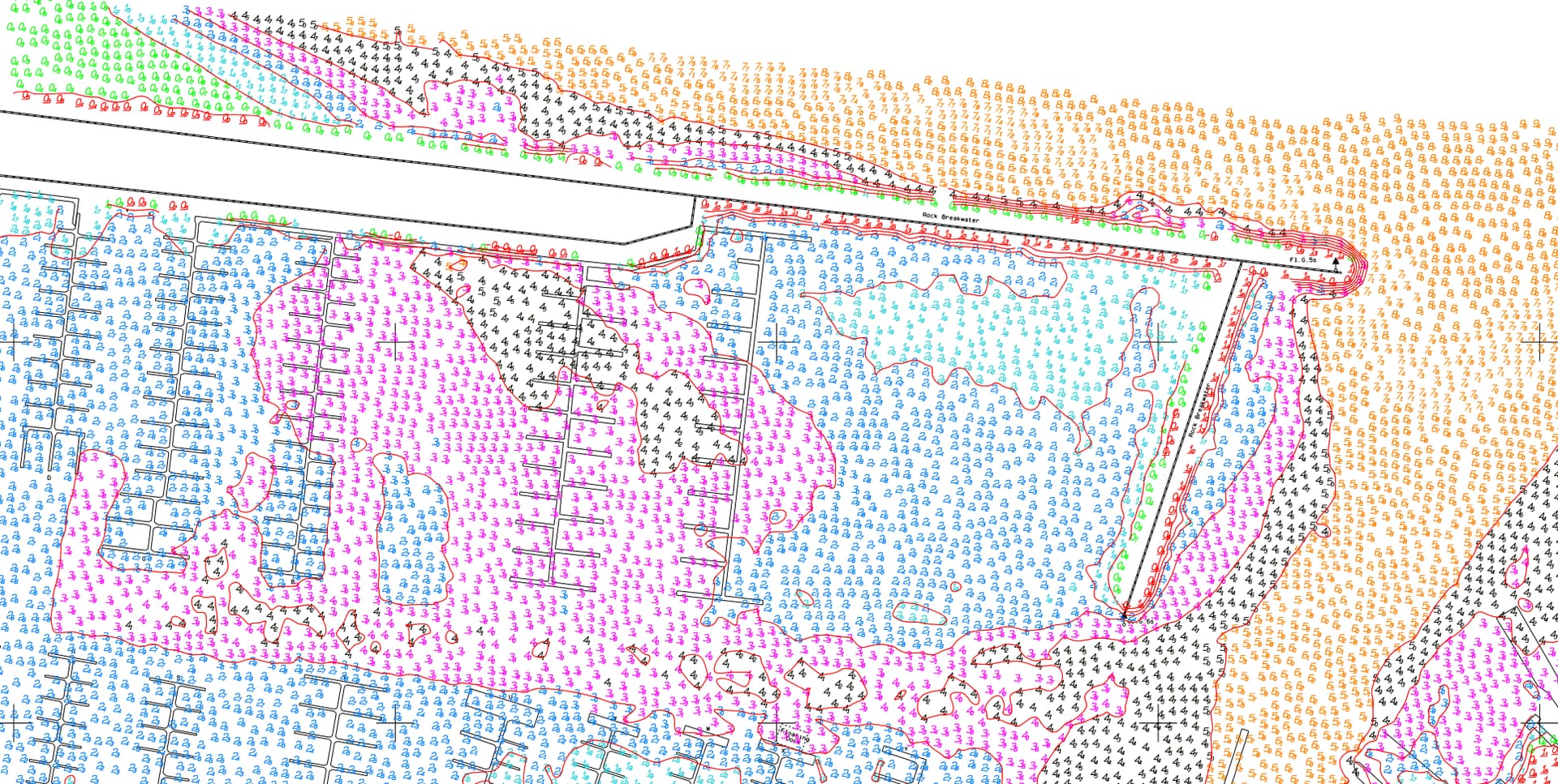
What’s the best way to extract a bathymetric survey from a PDF for use in Rockpile?
Looking for practical workflows—particularly:
-
Converting PDF contours or soundings into usable XYZ/surface data
-
Recommended intermediate tools (GIS, CAD, etc.)
-
Maintaining accuracy during conversion
-
vector PDFs
I would use PDF Manager to place the PDF and then extract the data and see what I have to work with. Is the sounding depth text or polyine text. If text we don’t have a specific tool to read that format and convert it, but we can probably get our Cloud Services to read it and convert it. If you have the original PDF and it is real text send it over and I can take a look next week when I am back. You would need to serve that up to the cloud services as a DXF file and describe how it is to be read and have the service convert it into normal text or points with the correct elevation.
I would think that AI already knows that type of notation for bathy surveys so if it is text I am sure I can get it to read it. If not OCR may work also.
It always depends on the data