RPS All Tools Command Library - Release Notes
March 2023
We are pleased to announce the latest release of the RPS All Tools Command Library. As with previous releases, this update introduces new commands and incorporates many updates to existing commands that further improve workflows, command capability or command performance.
New Commands
New commands for this release include the following
RPS Volumes Manager Command
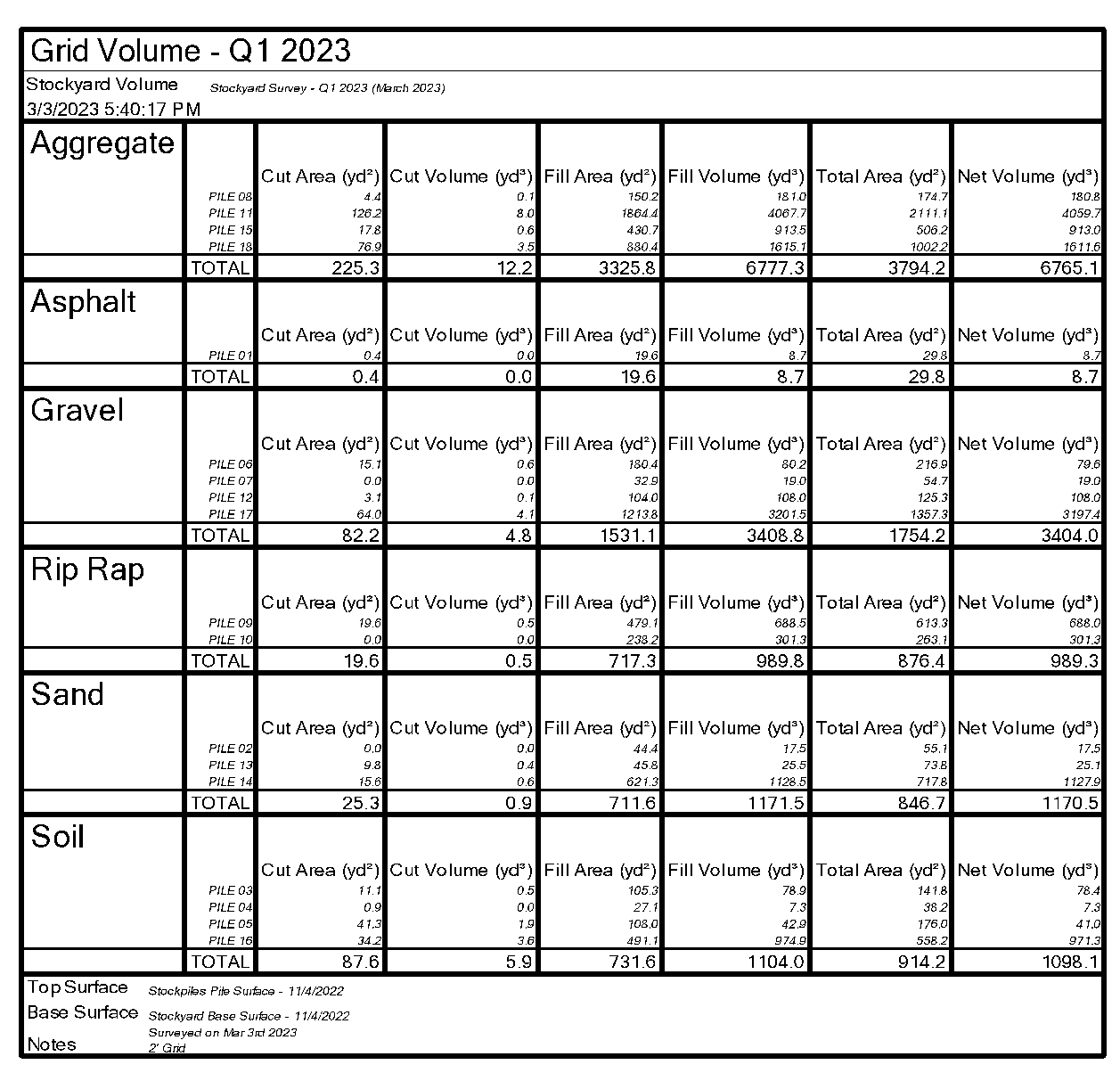
This command provides a fast and efficient way to compute and manage volumes on your projects. Define your boundaries, boundary collections and boundary groups, assign materials to the boundaries and boundary collections, define volume calculations for stockpiles or earthworks quantities and run your numbers. The process generates boundary tables of results in your drawings, a master table of all results for each calculation sorted by Material or by Boundary Group and stores the results for future recall and reference. Each volume boundary creates its own Cut Fill Map. Each volume calculation can be reported to a formatted PDF file or Excel Spreadsheet.
Volume report that can be recalled at any time
Process multiple boundaries and generate drawing elements automatically
Cut Fill Map and Volume Table per Boundary
Master Volume Table for a Calculation
Excel Output
RPS Polynomial Regrade Command
Continuing our work to support Solar Farm Construction, the Polynomial Regrade command has been written to create computed best fit grading lines through design pile locations for each solar array table complete with full QA analysis and labeling of results. Process thousands of design pile locations and hundreds of solar array tables in just a few seconds, and then review the results of your work both graphically and digitally.
Pre Calculation
Post Calculation
Color Coded Labels show fit (in / out of tolerance) of regrade lines to the source design points
RPS Custom Control Improvements
Layer Control
The layer control that is used in all RPS commands has been updated with an additional filter control that allows you to just display visible layers in the list of layers provided. This supplements the custom filter control and case sensitivity control added previously.
Improved Commands and Bug Fixes
Point Cloud Processor Command
This command has been improved to provide improved surface creation performance when the Lowest or Highest option are selected. In the prior release Lowest / Highest were not fully implemented. In the new version, when you select lowest or highest, the actual lowest or highest point is retained in the created point cloud in the location at which that point was found. When you select the Mean option, the mean coordinate location of all the points in the grid cell is used with the mean elevation (this corrects for edge cells where the entire cell may not be filled with point data (unlike cells in the main body of the survey). With these changes, you can now select a small grid interval e.g. 2’ and a high vertical tolerance e.g. 100’ and then use Lowest or Highest to find the lowest point or highest point in each grid cell. With this approach you can readily find the “ground surface” and eliminate vegetation like grasses, bushes, shrubs and tree canopy - provided that some ground points can be found in each grid cell.
Pre Processing Result using all data
Post Processing Result
Takeoff Lines Command
We have added the ability to turn Vector Snapping On and Off with the Hotkey V while drawing with this command. There are times e.g. when digitizing buildings and sidewalks where you do not want to snap to vector locations. This change makes it easy to toggle the vector snaps On and Off with a single keystroke.
Offset Slope Command
Minor bug fix to address a “TML Validation Error” that occurred in some situations
Pile Definition Manager Command
Minor improvements in line with user requests to improve performance and results
Smart Join Command
Added the Edit Linestring Command to the Header Bar commands in response to user requests
Multi Offset Line Command
Minor bug fix improvements
Text Style Manager Command
Minor bug fix improvement to eliminate the creation of duplicate text styles in certain situations.
Export XML Command
Improved handling of International Foot units on the export of alignments from International Foot projects.
Smart Copy Command
Command Versioning Issue - this command is now at 5.80
Help Command
Command Versioning issue - this command is now at 5.80


